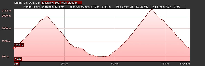
While the Stelvio Pass (2758m) can be ridden as an out-and-back, which is a nice option on a rain shortened day, this Stelvio Pass Loop ride is a bit more involved. In essence, we climb both sides of the Stelvio in the same day!
We climb out of Bormio toward the Stelvio, then turn north over Passo Umbrail (2498m)–cheating a bit, as Umbrail is 260m and 3 km below Stelvio–enter Switzerland at the pass, and descend to Santa Maria (1375m).
This lengthy descent into oftentimes much appreciated warmer temperatures has three distinct sections. First, an adequately paved alpine section, above tree line, with plenty of interesting switchbacks—visibility is generally good, so it can be fast and fun—but it's also steep in places, and largely open pasture with cows and "cow sign" unpredictably on the road.
Second, we'll face about 1.5 kilometers (1 mile) of unpaved road. Not too bad, as it's hard packed, wide, and nicely graded, but one must pay attention just the same. This section can be ridden irrespective of whether it's wet or dry—just keep your speed reasonable and ride smoothly.
Finally, we return to excellent pavement as we enter the forest, but our road becomes steeper and narrower. This section is a lot of fun, but you will need good brakes, especially after we break out of the trees into the meadows just above Santa Maria, as the road is wide open but steep—high speeds are possible, but there is no reduction in grade as we enter town, so it's not recommended.
From Santa Maria we turn right (descending) on 28/SS 41 and begin to circle Monte Cavallaccio clockwise to the east and south, descending steeply at first, re-entering Italy in Mustair (1249m). Gradually the pitch lessens, and after passing through Glorenza (921m) we'll enjoy some rollers the rest of the way into Prato allo Stelvio (922m).
We'll make sure to fuel up in Prato allo Stelvio—or as we begin our climb of Stelvio's east side—as plenty of energy will be necessary for the 48 tornanti (switchbacks) we'll face on our 1836 meter climb to Stelvio Pass!
From the top, we'll enjoy our well earned descent to Bormio, where a shower and post ride beer await!
Note: Route information comes from a variety of sources, including commercial products, personal experience, and from the public domain, and is always subject to errors, whether at the source, during computation, or at transcription, and is provided "as is"—to be used "at your own risk."

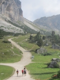 Cortina d'Ampezzo, long famous for its hiking and climbing, became world famous by hosting the 1956 Winter Olympics.Today, wonderful road cycling and mountain biking make Cortina a "must go" destination for active sports enthusiasts.Picture yourself riding, hiking, and mountain biking among the Dolomites' shear rock faces!
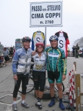 The Mortirolo, Gavia, & Stelvio–These famous Giro passes challenge you with their long climbs and fast descents!Bormio's picturesque alpine setting is perfect for tackling these passes, and its quiet old town center provides a true "Italian" experience!Less famous, Bormio's hiking and MTB are equally world class!
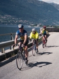 There's nothing like the water, sky, and mountains of Lago di Como!Popular with Italians for their summer vacations, countless boats of all varieties dot the deep blue water.After cycling and hiking among the lakeside villas and gardens, we "get out on the water," with a ferry ride back to our hotel!
 Wonderful biking and hiking around the Apli Apuane marble quarries of Michelangelo fame!Appearing snow-capped in summer, due to the bright-white marble, we hike and bike trails and roads built over 2000 years!With a scant 5 Km between alpi and mare–and the beach–our apres sport is a nap in the sun, and a dip in the Mediterranean!